Muhammad Osama Asghar is currently pursuing a Masters's degree in Geographical Information Systems and Remote Sensing from NUST, Islamabad. He holds a Bachelor's degree in Geophysics from Bahria University, Islamabad.
Introduction
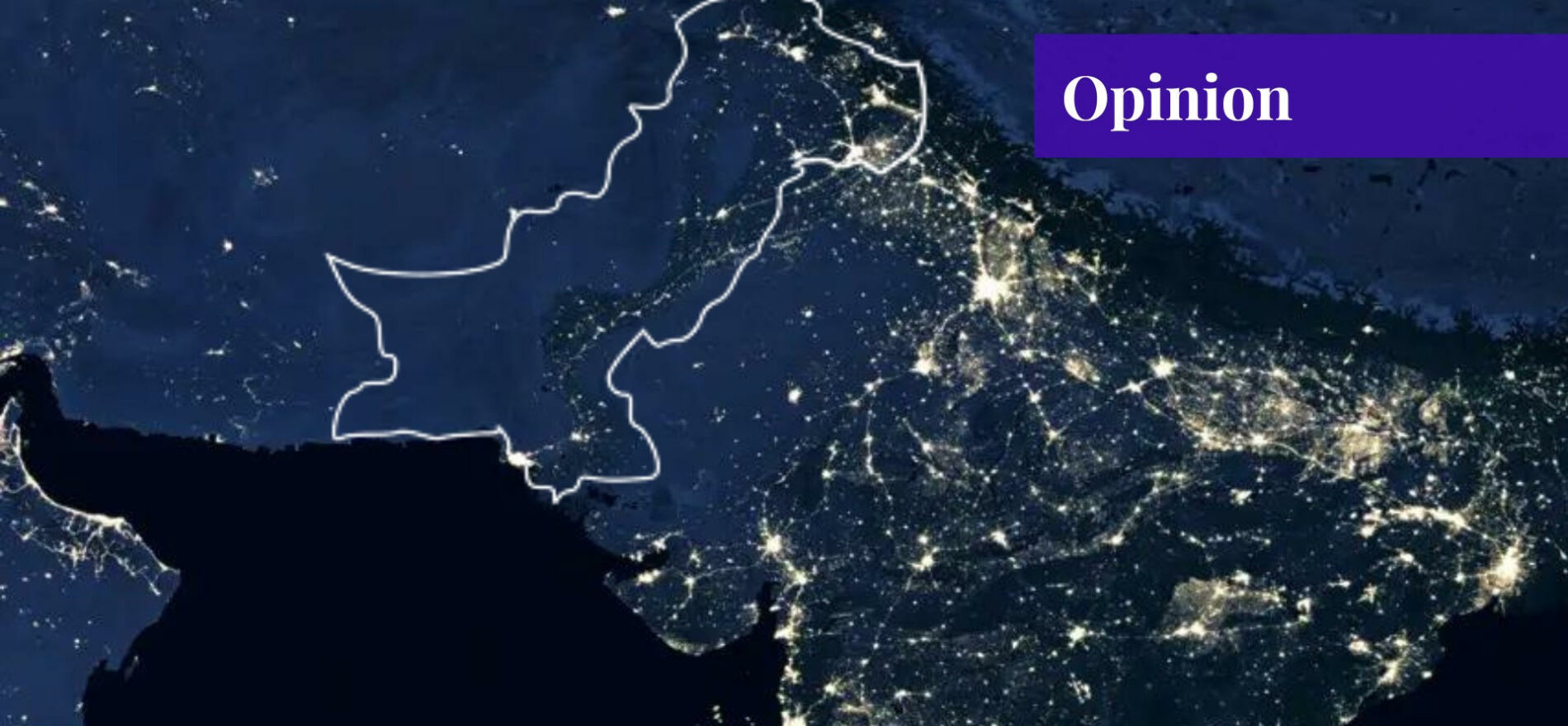
National security is geographical by definition because different regions have different physical conditions and cultural systems. In short, national security encompasses time, space, and the essence of what occurs inside those bounds of space-time.
A Geographic Information System (GIS) is a cadre of tools and datasets that are used to analyze, manipulate, and identify the geospatial aspect of things. From locating traffic congestion on Google Maps to analysing the meteorological patterns over our skies, almost every process that we study holds a geographic characteristic.
We know that our planet has been divided into latitudes and longitudes that define a specific location of an object on the map at a specific point in time. The study of these advanced mapping and navigation systems of can be used to enhance the national security apparatus of Pakistan.
GIS in Intelligence
National security is itself a spatial phenomenon, starting with the boundaries of a country. These borders are placed at a point of topographic barriers, such as a river, a mountain range, or a plateau, that help us in drawing a geographic line between two nation-states. Moreover, GIS and more precisely, Remote Sensing, via drones and satellites have been used by several security agencies to identify, locate, and eliminate targets simply by the press of a button via drones.
These drones are equipped with advanced sensors (or cameras) that are capable of zooming in to lengths we cannot begin to fathom. A simple example of the geographic information system (GIS) is how the CIA located Osama bin Ladin’s cabin in the middle of the heavily populated city of Abbottabad, Pakistan. Combining GEOINT (geospatial intelligence) with HUMINT (human intelligence), the CIA carried out a dramatic operation deep inside the Pakistani territory.
GIS in Domestic Security
Taking into consideration domestic security, the successful implementation of the geographic information system in the field of crime can significantly reduce unlawfulness in Pakistan. An example of this can be a proper WebGIS portal where crimes can be reported based on where they are occurring in a cluster. This can be displayed on a map for public awareness. Security in those hotspots could be increased. This increased security will flush out the lawless element in a matter of days.
Talking about surveillance, police can be equipped with a drone operating squad that can monitor the activity in real-time over a hotspot. If this model is successful for a small area, then perhaps one day, we can make ourselves able to monitor entire cities via autonomous drones that are able to identify criminal activity all on their own based on AI.
GIS in Situational Awareness
Moving forward, we saw a great example of an active geospatial situational awareness system when COVID-19 struck in 2020. We saw the creation of a web portal that divided the active, dead, and treated cases of the coronavirus. This web portal was available to the public with a touch of a button, and the data on this portal came directly from the general public. This contribution of individual humans who operate as sensors on the ground and contribute to an open-source platform can make a massive difference in situational awareness.
Secondary Areas of Implementation
We cannot ignore the other areas of geographic information system technology that can help protect Pakistan from natural calamities and economic stresses. There are various sectors in Pakistan that require a comprehensive framework for the implementation of bigger and better geospatial systems. These improved GIS and Remote Sensing systems will not only improve the workings of these sectors but also provide a boost to our economy and prevent unnecessary strains on our finances.
GIS in Disaster Management, Rescue, and Relief
One of the most amazing perks of GIS is its contribution to disaster response and mitigation. Observing the meteorological conditions, assessing the intensity of a storm, identifying the vulnerable spots or disaster-prone areas, and allowing smooth rescue and relief operations are some of the categories that involve GIS analysis.
We saw destructive floods in 2010, and now again in 2022 that strained our economic conditions even further. This could have been easily prevented had we assessed the intensity of the rainfall before it started pouring down. Therefore, the implementation of a strong GIS program in disaster management could create a massive difference in securing our fertile land, thereby, avoiding such calamities in the future.
GIS in Agricultural Security
Pakistan is an agricultural state that heavily depends on a good harvest. The more the yield, the more we earn from our exports and domestic consumers. The art of precision agriculture has been revolutionizing the agriculture industry since it was discovered. This precision agriculture technique is also a spatial phenomenon. Machine Learning and AI tools are coupled with geographical information systems to implement a model that increases the yield while decreasing the work done.
Almost every country is working on this aspect of the geographic information system, and Pakistan needs specific programs to promote this among the farming community. Perhaps educating them about its benefits, holding workshops and seminars, and spreading the word could be a solution.
GIS in Natural Resource Preservation
One of the gifts that Pakistan has been blessed with is the presence of numerous natural resources. From Tharparker’s massive seams of coal to Balochistan’s Riko Diq gold reserves, there are various hidden treasures that could sustain this country for a very long time. GIS can be used to identify, locate, and preserve these areas of high potential before they become ravaged by unauthorized human intervention.
GIS in Urban Planning
Rapid population growth is one of Pakistan’s major issues. This unguided rise in population is no less than an unguided missile for us. The growth in population gives way to an irregular pattern of urban sprawl. GIS can be used to monitor population growth in the country.
Government should implement strict measures in areas with denser population clusters and create an even pattern of distribution of the populace. As a dense cluster of inhabitants puts an immense strain on natural resources and facilities like groundwater access, this can be skilfully monitored and mitigated using GIS.
Conclusion
A strong GIS and Remote Sensing apparatus can help improve the national security of Pakistan from external, internal, natural, and man-made threats. To allocate resources in a disaster-prone area, we need a successful model to reduce street crime; to enhance our food security requiring public opinion over matters, a spatial aspect does exist.
The reason, in my opinion, why Pakistan lags behind in GIS technology is the lack of a functioning space program. That’s right, GIS and Remote Sensing heavily depend upon a strong space program as satellites that revolve around the earth give information that is obtained in real-time. Right now, we use data from Chinese satellites or American satellites, but these countries share low-quality data that can only be used to study large-scale phenomena.
For a good grasp and a deep analysis of the emerging situations, we need high-quality, high-resolution imagery that can only be obtained if Pakistan has its own satellites up and running. These satellites will provide us with reliable, good quality, and high-resolution datasets that we could use to monitor our borders, cities, and even neighbourhoods. It will be an invisible suit of armour around Pakistan, protecting it from foreign, domestic, and natural hazards.
If you want to submit your articles and/or research papers, please check the Submissions page.
The views and opinions expressed in this article/paper are the author’s own and do not necessarily reflect the editorial position of Paradigm Shift.
