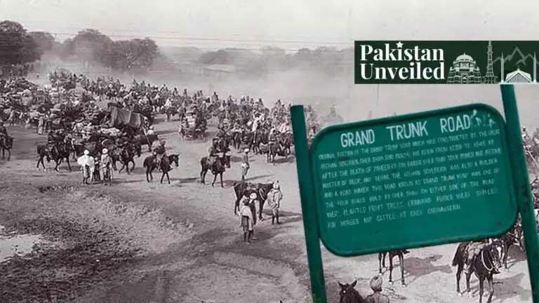

With a history that spans more than 2,500 years, the Grand Trunk Road (GT Road) is one of Asia’s oldest and longest major highways. It was said to have been built in the 3rd century BCE, extending from the mouth of the Ganges to the Northwestern frontier of India. Ancient Indian empires called the route “Uttarapatha,” or the Northern Road.
The GT road was formalized during the Mauryan period (3rd century B.C.). Megasthenes, a Greek historian, documented its eight stages from Purushupura (Peshawar) to Pataliputra (the Mauryan capital), with three stages: Purushupura to Takshasila, Takshasila to Jhelum, and Jhelum to Alexander’s Altars on the Beas River, which falls within modern-day Pakistan.
Stone pillars placed every 10 stadia (3.22 km) served as milestones. Emperor Asoka (r. 268–232 B.C.) further improved the road system, as recorded in his edicts. He planted trees, dug wells every half kos (1.6 km), and established nimisdhayas—interpreted by scholars like Sirkar as rest-houses or sarais—along the route, marking the earliest known reference to roadside halting stations.
Though ancient, a relatively more recent figure, primarily the Afghan King Sher Shah Suri, has been attributed to its construction and development.
Founder of the Suri Empire in the 16th century, Sher Shah’s developments to the route significantly ameliorated its quality. Sher Shah widened the road from Sonargaon in Bengal to Attock on the Indus River. This project was fantastically a medieval king with a relatively short reign, developing and fixing a road that covered a distance of approximately 4,500 km.
Introducing a standardized system of measurement for the road, he established milestones. He created a network of caravanserais (roadside inns) on the road, fulfilling caravan demand and being available every 20 kilometres. These caravanserais provided a secure resting area for travellers, flush with fresh water, food, and shelter. He also commissioned trees to be planted along the roadside to provide shade for weary travellers and their animals.
Expansion and Significance of GT Road
Subsequently, in the more glamorous Mughal period, the road was expanded and maintained. As Mughal leaders recognized its importance for military movements, administrative control, and commercial activities, they added their own contributions, including bridges and additional caravanserais. Sher Shah Suri had already built a strong foundation; they simply developed it.
The steep decay and decline of the GTR began around the 18th century. As Mughal authority faded, the region became ripe for conquest, as empires like the Durranis, Marathas, and Sikhs began to invade, and the highways started to become unsafe.
The British occupied the Punjab in 1849 and recognized the GTR’s importance as a gateway to the subcontinent. Between 1849 and 1886, they realigned and metalled the road and constructed bridges and culverts.
After Pakistan’s independence in 1947, the GT Road became a national highway (N-5) and has undergone continuous modernization. This included widening the width to accommodate increasing traffic, improving surfaces and drainage systems to increase sustainability, and building modern bridges and flyovers for increased traffic. They also developed the adjacent areas for commercial and residential purposes.
Today, the Grand Trunk Road stretches an incredible 2,400 kilometres (1,491 miles) from Kabul, Afghanistan, to Teknaf, Bangladesh.
The route links many major Pakistani cities, such as Lahore, Gujranwala, Jhelum, Rawalpindi, Nowshera, Attock, and Peshawar, before concluding its long journey at Landi Kotal, near the Afghan border.
Cultural Impact of The Grand Trunk Road
The areas along the GT Road in Pakistan showcase a blend of various languages, dialects, and culinary traditions. As one travels from Lahore to Peshawar, one sees a transition from Punjabi to Pashtun cultural influences.
Cities on the GT Road have historically been more cosmopolitan due to the constant flow of travellers and traders. The GT Road also passes by some extraordinary monuments and architectural landmarks that showcase the region’s rich history. These include monuments considered UNESCO World Heritage sites, such as the Lahore Fort, a 16th-century relic with its grand halls and intricate designs slipping you into a time machine.
Right next door is the Badshahi Mosque, currently one of the largest mosques in the world. It was built by the Great Emperor Aurangzeb in 1673.
Then there’s the Shalimar Gardens, a feat inspired heavily by Persian architecture. It’s a paradise with trickling fountains, lush greenery, and elegant pavilions.
Veering off the trodden path, you’ll find Rohtas Fort near Jhelum. It is a colossal 16th-century stronghold with imposing walls and an amazing history.
Moving closer to the Indus River, they’ll see Attock Fort, which Emperor Akbar raised in 1581. The fort guards a historic crossing with quiet strength.
The GT Road is lined with historic caravanserais (traveller rest houses) primarily built to support trade caravans. Many have been preserved and offer insights into historic trade patterns.
There are also some signs of colonial architectural influence. These can be seen in various buildings along the GT road, railway stations, government buildings, and churches, particularly in more diverse cities like Lahore and Rawalpindi.
Economic Significance of GT Road
Sher Shah Suri’s enhancements transformed the GTR into a major trade artery. The sarais, with their bazaars, encouraged commerce by providing secure stopovers for merchants. The road connected qasbas (urban settlements) to villages, facilitating revenue collection and extending royal control. The postal system, with horse-mounted messengers stationed at dak-posts within sarais, ensured rapid communication, enhancing administrative efficiency.
The GTR also significantly aided in urbanization. Many towns developed around sarais, with habitations often retaining the names of these now-dilapidated structures. The road linked strategic areas with forts, contributing to the growth of northern India’s urban centres, which remain more developed than other regions, as reported by historical analyses.
The road is currently an economic powerhouse. From antiquity to modern times, it remains one of Pakistan’s most important trade and transportation routes, with a mind-boggling 80% of Pakistan’s cargo transported via GT Road.
Naturally, being the major route of trade, cities littered along the GT Road have experienced immense urban growth and commercial development. The road has attracted a myriad of industries, such as warehouses, retail establishments, and real estate development. These help create job opportunities and develop the national economy.
As history dictates, it serves as a strategic trade route since it helps foster trade relations with Afghanistan and Central Asian countries, building a crucial link in regional economic integration.
Pakistani culture is obsessed with land ownership, so they’d be delighted to know that properties along the GT Road have seen substantial appreciation in value. The strategic location and connectivity have made areas along the GT Road prime locations for residential and commercial real estate investments.
Many industries have established manufacturing facilities along the GT Road, taking advantage of the road’s excellent transport connectivity. Industrial zones along the road contribute handsomely to Pakistan’s manufacturing sector.
The commercial activities along the GT Road employ millions of people, from transportation workers to retail employees, and contribute significantly to Pakistan’s economy.
Future Prospects for Pakistan
Recognizing its immense cultural heritage value, a recent initiative has aimed to transform the section from Quaid-e-Azam Interchange to the Wagah Border into a tourism corridor with a budget of Rs3.28 billion. The project currently includes reconstructing the specific part of the GT Road. The artificial wall in the form of a fence will highlight the culture of Lahore. Those coming to the Wagah Border and those coming from India to Pakistan will get a tourist corridor.
New urban developments along the GT Road, such as the New Metro City Gujar Khan, incorporate smart city concepts for sustainable development.
Pakistan is one of the most affected countries by climate change, and its inherent challenges have become apparent. There’s increased attention to making the GT Road and its adjacent areas more environmentally sustainable.
The GT Road continues to evolve as a critical component of regional economic integration initiatives, connecting Pakistan to broader Asian trade networks.
Conclusion
The Grand Trunk Road in Pakistan represents more than just a transportation route; it’s a historical artifact that continues to shape the nation’s economic, cultural, and social landscape. From its ancient origins to modern adaptations, the GT Road remains a powerful symbol of connectivity and continuity in Pakistan.
If you want to submit your articles and/or research papers, please visit the Submissions page.
To stay updated with the latest jobs, CSS news, internships, scholarships, and current affairs articles, join our Community Forum!
The views and opinions expressed in this article/paper are the author’s own and do not necessarily reflect the editorial position of Paradigm Shift.
The author is studying Economics at the National University of Science and Technology (NUST) with a keen interest in financial affairs, international relations, and geo-politics.