Abstract
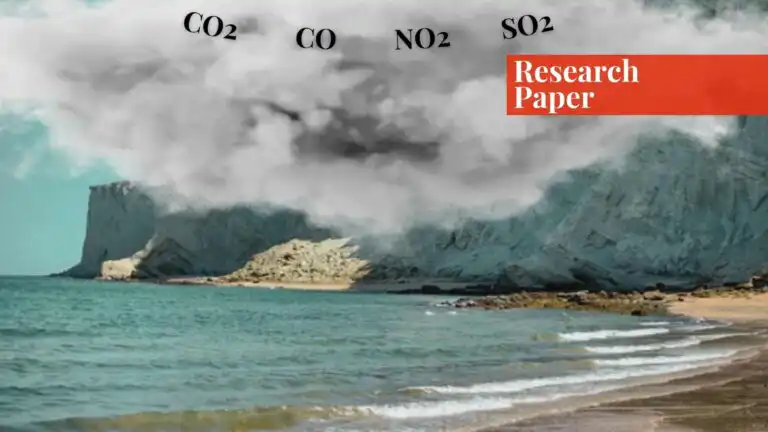
Shipping operations have an environmental impact both in ports, as well as in the immediate vicinity of the coast. These impacts are due to the fuel burning exhaust from the ship’s main and auxiliary engines which contain gases like carbon dioxide (CO2), carbon monoxide (CO), nitrogen dioxide (NO2) and sulphur dioxide (SO2) and machinery used for loading and unloading, in addition to particulate matter and dust from the handling of materials such as grain, coal, and sand.
Remote Sensing (RS) and Geographic Information System (GIS) are efficient tools being used worldwide for the monitoring of environmental problems. The response of Earth’s atmosphere or surface to electromagnetic radiation can be mapped through RS for the status of changes in the natural environment. Smart sensors developed for detection of air pollutants is an emerging technique to monitor emissions for real time monitoring and management of air pollution in distant regions.
In the current study, satellite data is used to investigate concentrations of key emissions from shipping operations at ports to analyse the status of air pollutants over coastal regions of Pakistan. The pollutants investigated in this study through RS and GIS technique include CO2, SO2, NO2, CO and Particulate Matter (PM). These emission trends can be used to determine the efficacy of mitigatory measures to reduce emissions at ports and monitor the air quality of coastal areas. Furthermore, use of scientific technology and current trends in the measurement and monitoring of shipping emission have been studied for their applicability in Pakistan.
Introduction
Shipping facilitates most of the international trade and is often termed as more environmentally friendly as compared to other modes of transportation. Maritime transport has grown rapidly and significantly in recent decades as worldwide commerce and economic demands have increased. Furthermore, with ports available all over the world, marine transport is currently the most economical means of transportation for crossing long distances and for carrying huge amounts of merchandise.
Ships, like all modes of transportation, emit pollutants, most notably carbon dioxide, which contributes to global climate change and ocean acidification. Shipping is still significantly reliant on polluting fuels, accounting for about 2% of global greenhouse gas (GHG) emissions in 2020. Transportation-related CO2 emissions globally have increased dramatically, beginning at 2.84 billion GtCO2 in 1970 and rising to 7.64 billion GtCO2 by 2021, owing to the growth of both global populations and economies.
Since emissions from shipping sector occur in different parts of the world, it is difficult to infer which country is the largest polluter in the sector; however, global shipping, if it were a country, would be the world’s eighth-largest carbon dioxide emitter. The considerable growth in global shipping activity has amplified the creation of harmful contaminants.
While cleaner fuels are gaining popularity, transportation businesses continue to rely on fossil fuels like marine gas oil and heavy fuel oil. Marine fuel oil of low quality has 3,500 times more sulphur content as compared to road diesel and hence ports contribute significantly to air pollution issues in coastal areas. The emissions of hazardous gases and particles expose coastal communities to substantial health and environmental risks.
Exhaust gas emissions are becoming a more pressing public concern in the context of the merchant marine industry. Port emissions arise from a variety of sources, including fuel-powered ships, cargo handling gear, harbor craft, heavy vehicles for carrying cargo and rail locomotives, port administration automobiles, power plants that provide electricity for seaports processes, and so on.
Ship emissions from maritime power plants are directly tied to a set of factors representing engine utilization, namely: propulsion and auxiliary machinery, fuel utilized, combustion temperature, cruise speed, and navigation phases. Heavy fuel oil (HFO) combustion emits hazardous gasses such as carbon dioxide (CO2), methane (CH4), and nitrous oxide (N2O), all of which contribute to the problem of climate change.
Ships also emit emissions of sulfur oxides (SOx), which, while not directly affecting climate, offer major environmental and health problems. In terms of greenhouse gas (GHG) emissions, carbon dioxide (CO2) is the most significant pollutant. The concentration of atmospheric CO2 is continuously increasing, owing primarily to manmade activities, and if it continues to climb at the current rate, around 1.5 degrees Celsius of global warming could be reached by the middle of this century, resulting in more climate extremes.
While GHG emissions from the shipping industry have been increasing, sulfur dioxide (SO2) emissions have been decreasing since 2009 due to sulfur content regulations in marine fuels. The shipping sector’s emission can be broadly classified into two categories:
- Gaseous pollutant emissions: Ships visiting ports utilize heavy fuels, which release atmospheric pollutants such as carbon dioxide (CO2), sulfur oxides (SOx), nitrogen oxides (NOx), and other gases. Furthermore, land vehicles used in ports including trucks, rails, buses, and freight handling equipment emit pollutants like NOx and CO2.
- Particulate Matter (PM) and dust: Ships and other port operations including loading and unloading processes, generate dust and suspended particulates that contribute to air pollution, particularly while handling materials such as coal, minerals, and grain.
Due to global climate change, emissions from shipping operations have attracted substantial attention in industrialized nations during recent years, while governments and port authorities of developing countries are trying hard to address this immediate and catastrophic issue. This increase focus on emissions from shipping sector is primarily because of a growing demand for reduced global emissions in all sectors to meet the goals of Paris Agreement. Besides, the fact that the shipping sector is one of the fastest growing sectors in terms of GHG emissions, makes it imperative for the world to transform to greener shipping operations.
In parallel, many ports around the world have introduced policies and regulations to mitigate these emissions. Recently, International Maritime Organization (IMO) member states updated the “IMO GHG Strategy 2023”, committing to reach net-zero GHG emissions by the year 2050 and establishing interim reduction goals of 20% by 2030 and 70% by 2040, compared to 2008 levels. This enhanced strategy, while not legally binding in itself, is supported by enforceable and legally binding measures such as the Energy Efficiency Existing Ship Index (EEXI) and the Carbon Intensity Indicator (CII), which took effect in 2023 under an amendment in the MARPOL treaty of 1980.
Countries must ensure that their fleets comply with these standards as many member countries may deny port entry to non-compliant vessels. While scientifically advanced countries are moving towards greener shipping, which would help in significantly reducing the emissions at sea, the developing and underdeveloped countries are finding it exceedingly hard to transition to greener shipping. One of the obvious reason is non-access to technology, but the other underlying factor is the financial constraints in order to afford new and expensive technology.
In the prevalent global emphasis on climate change and spotlight being directed on the shipping sector, it has become necessary for Pakistan to monitor its shipping sector emissions. This situation demands taking measures to transform the country’s shipping operations to conform to international standards and introduction of cleaner fuel for the ships, among other necessary measures.
This study aims to analyze the situation of air quality over the major ports of Pakistan, using remote sensing and Geographic Information System (RS and GIS) techniques by employing satellite data for pollutants. Furthermore, the study would explore scientific methods like low-cost sensors that are being used worldwide to monitor air quality and emission status at ports and their applicability in Pakistan.
Research Methodology
Study Region
The study focuses on the coastal regions of Pakistan, as shown in the Figure 1. Five major ports of Pakistan have been selected for this study, for monitoring the concentrations of key atmospheric pollutants in the region (depicted in Table 1). You’ll also see the map of the coastal areas of Pakistan below (Source: SUPARCO Pakistan, )

| Port | Latitude | Longitude |
| Karachi Port | 24.83 N | 66.98 E |
| Muhammad bin Qasim | 24.76 N | 67.33 E |
| Gwadar | 25.11 N | 64.34 E |
| Ormara | 25.2 N | 64.67 E |
| Keti Bandar | 24.14 N | 67.45 E |
Datasets
The parameters selected to evaluate and monitor air quality of the coastal regions of Pakistan, based on the major emissions from the shipping sector are:
⦁ Nitrogen dioxide (NO2)
⦁ Sulphur dioxide (SO2)
⦁ Carbon monoxide (CO)
⦁ Carbon dioxide (CO2)
⦁ Particulate Matter sized less than 2.5µm (PM2.5)
All the parameters have been mapped and evaluated by using data from different satellites, based on the spatiotemporal availability of the data over the region. The satellite data that has been used in the study has been detailed below.
The TROPOspheric Monitoring Instrument (TROPOMI)
Satellite remote sensing is a technique extensively used to monitor atmospheric levels of pollutants worldwide. The TROPOspheric Monitoring Instrument (TROPOMI), was launched on 13 October 2017. It was a joint project of the Netherlands and Europe Space Agency (ESA) and is a UV to shortwave infrared backscattering sensor on board the sun-synchronous Sentinel-5 Precursor (S5P) satellite with an overpass time of 13:30 local solar time.
The S5P works to acquire atmospheric composition and monitor air quality including pollutants such as Ozone (O3), carbon monoxide (CO), Nitrogen Dioxide (NO2), Sulphur Dioxide (SO2), Methane (CH4), formaldehyde (HCHO) and aerosol properties. With a wide swath of 2600 km and an unprecedentedly high horizontal resolution of 3.5 km×7 km, (3.5 km×5.5 km since 6 August 2019) TROPOMI achieves daily global coverage, which makes it suitable for daily air quality monitoring worldwide.
OMI
This study employs columns of tropospheric NO2 retrieved from Ozone Monitoring Instrument-OMI onboard NASA’s EOS-Aura satellite. OMI was launched in July 2004 and circles the Earth in a sun synchronous, near-polar path. It passes the equator at 13:40 local time and works in three spectral channels between 264 to 504 nm at an average spectral resolution of 0.5 nm.
The spatial resolution is about 13 × 24 km2 at nadir. If there is no technical hindrance, OMI can image the complete globe once every 24 hours. OMI measures ozone, aerosols, clouds, surface UV irradiance, and trace gases including NO2, SO2, using UV electromagnetic spectrum bands. OMI, before the launch of TROPOMI, had been used broadly to study the atmospheric properties and characteristics at both regional and global levels and collected more than a decade of important data.
Measurements Of Pollution In The Troposphere (MOPITT)
MOPITT is a remote sensing instrument onboard NASA’s Earth Observing System Terra spacecraft, which measures and records tropospheric carbon monoxide (CO) on the global scale. MOPITT has been operational since March 2000. MOPITT capacities have enabled the scientific investigations about the prevalence, transportation, sources and sinks of CO. CO is a trace gas produced by breakdown of methane, fossil fuel consumption and biomass burning. This study utilises CO data from MOPITT from 2010 to 2021 to map concentrations around the area of interest.
Copernicus Atmospheric Monitoring Service (CAMS)
Particulate Matter consists of solid and liquid particles that are directly emitted into the atmosphere because of diesel use, road and agricultural dust, and industrial activity. PM2.5 is composed of tiny particles with size less than 2.5 µm that are emitted directly into the atmosphere and secondary particles produced by chemical reactions between precursor gases.
PM serves as a significant potential danger to human health. PM2.5 due to its small size, is inhaled in through the respiratory system and further infiltrate the lung alveoli to reach the bloodstream causing a myriad of serious diseases. It may cause serious health issues for workers and even residents in port areas. Fine dust and black carbon emitted from fuel burning and coal handling is known to cause damage to ship equipment and expensive naval installations nears the coastal areas.
Copernicus Atmosphere Monitoring Service (CAMS) provides operational daily analysis and forecast of aerosols including PM2.5 since 2016. The daily data from CAMS has been used for this study for the time period of 2016-2022.
Results and Discussions
Emissions of NO2 over Coastal Areas of Pakistan
Nitrogen oxides (NOx = NO + NO2) are critical gaseous contaminants found in the troposphere. NOx plays a role in the production of ozone (O3) and particulate matter leading to increased levels of oxidants in the troposphere, which affect air quality and human health. Tropospheric NO2 emissions are further characterised as anthropogenic and natural sources.
Burning of fossil fuels is by far the most dominant source of NOx, especially in and around urban areas. Additionally, biomass burning, lightning and soil emissions are also eminent causes of NO2 formation. The use of fossil fuels in shipping sector make them a source of NOx as well, causing NOx pollution in port cities. Although the concentrations of NO2 have shown a decline in 2015 and 2022 as compared to 2010, they are still present in significant amounts around port cities. Karachi port was the port with highest NO2 concentration in 2010, while Muhammad bin Qasim Port recorded the highest concentrations in 2015 and 2022.
The Karachi Port is the largest deep seaport of Pakistan. Owned by the Ministry of Maritime Affairs and managed by the Karachi Port Trust (KPT), it handles nearly 60% of national shipments while Port Qasim is the second busiest port of Pakistan handling about 35% of the nation’s cargo and both ports naturally serve as considerable source of emissions. These emission concentrations for five major ports are depicted in Table 2.
| NO2 (mol/cm2) | 2010 | 2015 | 2022 |
| Karachi Port | 6.78E+15 | 1.73E+15 | 1.08E+15 |
| Muhammad bin Qasim | 4.48E+15 | 2.42E+15 | 2.19E+15 |
| Gwadar | 9.82E+14 | 8.58E+14 | 8.75E+14 |
| Ormara | 1.25E+15 | 9.19E+14 | 8.58E+14 |
| Keti Bandar | 1.45E+15 | 6.98E+14 | 6.93E+14 |
| SO2 (DU) | 2010 | 2015 | 2022 |
| Karachi Port | 0.09 | 0.16 | 0.11 |
| Muhammad bin Qasim | 0.13 | 0.09 | 0.08 |
| Gwadar | 0.04 | 0.05 | 0.01 |
| Ormara | 0.05 | 0.05 | 0.02 |
| Keti Bandar | 0.03 | 0.002 | 0.04 |
| CO (mol/cm2) | 2010 | 2015 | 2022 |
| Karachi Port | 1.91E+18 | 1.87E+18 | 2.11E+18 |
| Muhammad bin Qasim | 1.91E+18 | 1.87E+18 | 2.11E+18 |
| Gwadar | 1.81E+18 | 1.73E+18 | 1.9E+18 |
| Ormara | 1.67E+18 | 1.83E+18 | 1.95E+18 |
| Keti Bandar | 1.78E+18 | 1.97E+18 | 2.08E+18 |
| CO2 (ppm) | 2010 | 2017 | — |
| Karachi Port | 389.75 | 402.37 | — |
| Muhammad bin Qasim | 389.75 | 402.37 | — |
| Gwadar | 390.18 | 402.76 | — |
| Ormara | 390.18 | 402.76 | — |
| Keti Bandar | 389.75 | 402.37 | — |
Emissions of Sulphur Dioxide (SO2) over Coastal Areas of Pakistan
Sulphur dioxide is mainly emitted into the atmosphere as a result of combustion of fossil fuels that contain sulphur, such as coal and oil. In the coastal areas, it is mainly emitted from fuel containing sulphur in ships and other shipping operations. SO2 emissions are the highest at Karachi port followed by Muhammad bin Qasim Port.
However, these emissions are not very high at the region, because these concentrations are averaged over the year. There is a possibility of isolated SO2 spikes related to an accident but overall, SO2 concentrations were not identified as being significant over the region. Figure 3 depicts the map of SO2 over the study region.
Emissions of Carbon Monoxide (CO) over Coastal Areas of Pakistan
Carbon monoxide (CO), which is released into the air due to incomplete combustion of fossil fuels, biomass burning and forest fires, is an important criteria pollutant included in ambient air quality standards. The CO released into the atmosphere impacts human life and plays a role in global warming as well. Exposure to high levels of carbon monoxide over a long period of time can lead to respiratory and cardiovascular diseases, developing of neuropsychiatric conditions and other illnesses and can even be fatal.
CO accumulation in residential and industrial units has caused deadly accidents in the past in Pakistan, therefore it is widely known to be a hazardous gas even in small concentrations. Results of CO concentrations mapping over coastal area of Pakistan showed that the concentrations increased in 2022 as compared to 2020 and 2015. The highest concentrations of CO were recorded at largest ports i.e., Karachi Port and Muhammad bin Qasim Port in 2010 and 2022, while Keti Bandar Port had the highest concentration of CO in 2015.
Emissions of Carbon Dioxide (CO2) over Coastal Areas of Pakistan
CO2 is the most potent gas responsible for global warming and it is one of the highest pollutants of the shipping sector. Worldwide shipping emissions contributed 1 billion tonnes of CO2 in 2018 alone and were accountable for around 2.9% of total anthropogenic emissions. A study by Hussain et al estimated pollutant emissions at the Muhammad bin Qasim port of Pakistan and concluded that container ships are the largest emitters of air pollutants, followed by tankers.
According to the study, the main reason for container ships’ maximum emissions is the engine powers and emission factors associated with residual oil fuel. It was also noted in the study that CO2 had the highest percentage in emission totals in the shipping sector (more than 92% of the total), since it is the primary byproduct of burning fossil fuel. CO2 has a long half life and stays in the atmosphere for almost a century, thus once emitted, it is not easy to sequester it.
Despite being the primary pollutants caused by shipping operations, it is hard to identify the CO2 emission source by remote sensing techniques as it is a well-mixed gas with a long half-life in the atmosphere. Hence remotely sensed CO2 concentrations in any area would conform to the global trends, as depicted in the figure below.

Particulate Matter (PM2.5) over Coastal Areas of Pakistan
Particulate matter emissions from shipping sector are responsible for up to 14% of PM2.5 concentrations found in coastal regions of Europe for up to 25% in shipping hotspot areas. It has been observed that switching to cleaner fuels for ships not only resulted in considerable reductions in shipping-source-related PM2.5 at a port site but also at an urban background site.
PM2.5 concentrations taken from CAMS website, were analysed during 2016 and 2022 using the CAMS satellite data as this was the temporal range of data available. PM2.5 has a decreasing trend in the particulate matter as shown in Figure 6. However, these values still remain much higher than the ambient air standards of WHO which cap the PM2.5 measures under 35µg/m3 for 24 hours average and 75 µg/m3 for annual average.
The decreasing trend might be due to use of low sulphur fuel in ships during recent years. According to another study over Karachi, the PM10 and PM2.5 readings are often two to three times higher than the air quality standard requirements.

Current Technological Trends in Measurement of Shipping Emissions
In order to assess the effect of ships traffic and harbour operations on air quality and atmospheric composition to plan efficient mitigation strategies, there is a growing need for reliable scientific measurement tools. Rapid development of new technologies in recent years has opened various avenues for real time monitoring of ship emissions and their effect on air quality.
Some of these techniques are discussed in this section, which can be useful for air quality monitoring and regulating emission at ports of Pakistan as well. In Pakistan Pakistan Environmental Protection Agency (Pak EPA) and provincial EPAs are mandated to monitor environmental parameters and pollutants.
Emerging technologies in air emissions from port operations and shipping sector can be measured by provincial EPAs and port authorities, in close coordination with agencies like Pakistan Maritime Security Agency (PMSA), Pakistan National Shipping Corporation (PNSC) and other relevant bodies.
Low-cost Sensors at Ports
A system based on the incorporation of air quality measurements taken by using a network of low cost sensors with local-scale dispersion modelling can be a handy monitoring tool for port areas for measuring emissions. Experiments have proved that such can be operated in near-real-time as well as in forecast mode, and on archived data for long-term assessments as explained in the study by authors.
Portable Exhaust Monitoring Devices
Portable exhaust monitoring devices can be useful for measuring emissions from mobile sources such as marine traffic and over vast expanses of sea. A portable device can be mounted on drones, patrol boats, docks, bridge cranes, or other maritime equipment, to carry out all-weather and real time monitoring of emissions from ships. The device utilises suction to sample and measure the content of pollutants in the exhaust gas and can transmit the results to a cloud server using 4G transmission.
On-board Solutions
There are various on-board tools developed in recent years for ships to measure and clean the exhaust from the ships. These include marine exhaust analysers, marine and shipping emission controllers, exhaust cleaners and scrubbers among others. One recent development in the field is to use and complement the data from the Automatic Identification System (AIS) trackers that all ships carry. Connecting ships’ AIS data of location and speed with parameters like engine power and fuel consumption rate can calculate a composite view of carbon emissions of a ship.
Advancements in satellite technologies
Satellite remote sensing of air pollutants has been in practice since many decades but measuring point sources of ship pollution were not very accurate because of atmospheric dynamics and diverse satellites’ properties. In recent years, European Space Agency’s Sentinel 5 satellite has been experimented successfully to measure the concentration of NOx in shipping lanes.
Now efforts are in line to put up a satellite specifically for the macro-monitoring of CO2. There is optimism about the initiative, and it is being hoped that that the new, carbon-tracking satellite would be in orbit sometime in the current decade, providing yet another scientific means for checking the health of the planet.
In Pakistan Space and Upper Atmosphere Research Commission (SUPARCO) is the leading body working on satellite technology development for applicability in Remote Sensing data products, agriculture, forestry, disaster management, water resources, environment, urban planning and management, coastal and marine resources and management etc.
Conclusion
The study investigates the status of key shipping emissions on the coastal areas of Pakistan and scientific methods that can be employed for monitoring and containing pollutants. It is observed that NO2 and SO2 concentrations have not shown a significant increase from 2010 levels despite an increase in the shipping traffic and operations, which can be attributed to stricter international regulations pertaining to use of low sulphur fuel.
CO and CO2 concentrations have risen in the last decade in the coastal regions of Pakistan. PM2.5 concentrations have decreased in the time span of 2016 to 2022, however they still remain above the allowable limits of WHO. Human health and environmental impacts of shipping sector are huge and need to be taken seriously in developing countries like Pakistan, where they are often overlooked.
Monitoring and measurement of ship emissions face challenges in the realm of scientifically organizing ship emissions data, data acquisition, transmission, and analysis, as well as information services for local population and policy makers. Hence, novel insights and understanding among the key stakeholders in government, industry, and civil society should be developed to facilitate cross-sectoral engagements, necessary for the effective implementation of international and national regulations pertaining to shipping sector and easier transition to green shipping.
The technologies involved are no doubt expensive, but the dividends are high; we must protect the environment for our future generation. In the case of environmental monitoring in Pakistan, policy formulation and laws do exist but there is a need for implementation and enforcement.
Bibliography
- Adil Tawfiq, Mohamed Mansour, and Ahmed El-Taybany, “Assessment Of The Emissions From Seagoing Ships In Suez Canal,” Port-Said Engineering Research Journal 21, no. 2 (September 1, 2017): 128–37, https://doi.org/10.21608/pserj.2017.33301.
- Amanda Comings, “How the Push for Cleaner Air Dirtied the Water: The Shipping Industry and Its Impact on the Environment,” California Western International Law Journal 53, no. 2 (April 1, 2023), https://scholarlycommons.law.cwsl.edu/cwilj/vol53/iss2/10.
- Anis Asma Ahmad Mohtar et al., “Variation of Major Air Pollutants in Different Seasonal Conditions in an Urban Environment in Malaysia,” Geoscience Letters 5, no. 1 (September 11, 2018): 21, https://doi.org/10.1186/s40562-018-0122-y.
- Anthony Sardain, Erik Sardain, and Brian Leung, “Global Forecasts of Shipping Traffic and Biological Invasions to 2050,” Nature Sustainability 2, no. 4 (March 18, 2019): 274–82, https://doi.org/10.1038/s41893-019-0245-y.
- Azfar Hussain et al., “Spatiotemporal Temperature Trends over Homogenous Climatic Regions of Pakistan during 1961–2017,” Theoretical and Applied Climatology 153, no. 1 (July 1, 2023): 397–415, https://doi.org/10.1007/s00704-023-04484-3.
- Bozzo, A., S. Remy, A. Benedetti, J.Flemming, P. Bechtold, M.J. Rodwell, and J.-J. Morcrette, 2017: Implementation of a CAMS-based aerosol climatology in the IFSA. ECMWF Technical Memorandum 801, 33 pp
- C. A. McLinden et al., “Improved Satellite Retrievals of NO2 and SO2 over the Canadian Oil Sands and Comparisons with Surface Measurements,” Atmospheric Chemistry and Physics 14, no. 7 (April 9, 2014): 3637–56, https://doi.org/10.5194/acp-14-3637-2014.
- Chunjiao Wang et al., “Comparison and Validation of TROPOMI and OMI NO2 Observations over China,” Atmosphere 11, no. 6 (June 2020): 636, https://doi.org/10.3390/atmos11060636.
- Eunhwa Jang et al., “Impact of Shipping Emissions Regulation on Urban Aerosol Composition Changes Revealed by Receptor and Numerical Modelling,” Npj Climate and Atmospheric Science 6, no. 1 (May 29, 2023): 1–13, https://doi.org/10.1038/s41612-023-00364-9.
- Eva Merico, Adelaide Dinoi, and Daniele Contini, “Development of an Integrated Modelling-Measurement System for near-Real-Time Estimates of Harbour Activity Impact to Atmospheric Pollution in Coastal Cities,” Transportation Research Part D: Transport and Environment 73, no. 0 (August 2019), https://trid.trb.org/view/1633602.
- Fan Zhou et al., “A Real-Time Measurement-Modeling System for Ship Air Pollution Emission Factors,” Journal of Marine Science and Engineering 10, no. 6 (June 2022): 760, https://doi.org/10.3390/jmse10060760.
- Gerard Hoek et al., “Long-Term Air Pollution Exposure and Cardio- Respiratory Mortality: A Review,” Environmental Health 12, no. 1 (May 28, 2013): 43, https://doi.org/10.1186/1476-069X-12-43.
- Hoegh-Guldberg, O., D. Jacob, M. Taylor, M. Bindi, S. Brown, I. Camilloni, A. Diedhiou, R. Djalante, K.L. Ebi, F. Engelbrecht, J.Guiot, Y. Hijioka, S. Mehrotra, A. Payne, S.I. Seneviratne, A. Thomas, R. Warren, and G. Zhou, 2018: Impacts of 1.5ºC Global Warming on Natural and Human Systems. In: Global Warming of 1.5°C. An IPCC Special Report on the impacts of global warming of 1.5°C above pre-industrial levels and related global greenhouse gas emission pathways, in the context of strengthening the global response to the threat of climate change, sustainable development, and efforts to eradicate poverty.
- Hulda Winnes, Linda Styhre, and Erik Fridell, “Reducing GHG Emissions from Ships in Port Areas,” Research in Transportation Business & Management, Energy Efficiency in Maritime Logistics Chains, 17 (December 1, 2015): 73–82, https://doi.org/10.1016/j.rtbm.2015.10.008.
- Hussain et al., “Spatiotemporal Temperature Trends over Homogenous Climatic Regions of Pakistan during 1961–2017.”
- Iftikhar Hussain et al., “Estimation of Shipping Emissions in Developing Country: A Case Study of Mohammad Bin Qasim Port, Pakistan,” International Journal of Environmental Research and Public Health 19, no. 19 (January 2022): 11868, https://doi.org/10.3390/ijerph191911868.
- Mohammad Idrees, Yasmin Nergis, and Muhammad Irfan, “Industrial Emission Monitoring and Assessment of Air Quality in Karachi Coastal City, Pakistan,” Atmosphere 14, no. 10 (October 2023): 1515, https://doi.org/10.3390/atmos14101515.
- N. A. Krotkov et al., “Aura OMI Observations of Regional SO2 and NO2 Pollution Changes from 2005 to 2014,” preprint (Gases/Remote Sensing/Troposphere/Chemistry (chemical composition and reactions), October 1, 2015), https://doi.org/10.5194/acpd-15-26555-2015.
- Prakash Thangavel, Duckshin Park, and Young-Chul Lee, “Recent Insights into Particulate Matter (PM2.5)-Mediated Toxicity in Humans: An Overview,” International Journal of Environmental Research and Public Health 19, no. 12 (June 19, 2022): 7511, https://doi.org/10.3390/ijerph19127511.
- Wang, Chunjiao, Ting Wang, Pucai Wang, and Vadim Rakitin. “Comparison and Validation of TROPOMI and OMI NO2 Observations over China.” Atmosphere 11, no. 6 (June 2020): 636. https://doi.org/10.3390/atmos11060636.
- Zheng Wan et al., “Pollution: Three Steps to a Green Shipping Industry,” Nature 530, no. 7590 (February 2016): 275–77, https://doi.org/10.1038/530275a.
This piece was originally published in the Pakistan Journal of Medical Research
If you want to submit your articles, research papers, and book reviews, please check the Submissions page.
The views and opinions expressed in this article/paper are the author’s own and do not necessarily reflect the editorial position of Paradigm Shift.
Mr Bilal Abdul Nasir is the Director of the National Institute of Maritime Affairs (NIMA), Islamabad.
Ms Fasiha Safdar is the Associate Research Fellow at the National Institute of Maritime Affairs (NIMA), Islamabad.
Ms Saba Zeenat is the Research Assistant at the National Institute of Maritime Affairs (NIMA), Islamabad.