
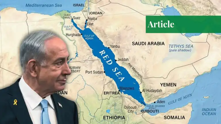
In the event that Benjamin Netanyahu appeared before a slide labeled “Convergence of axes” on 18 October, the obvious question that was asked in most comments was who was a coloured friend and who a foe. The more instructive question is which colour is where. The map behind him was identical to one that was published by the Friedrich-Ebert-Stiftung in May 2026, with Puntland and Somaliland shaded in light blue, as the legend reads, “Israel and UAE consider friendly”. This is a map of the “Middle East”, where land in the Horn of Africa is coloured, making an argument about geography, and an argument about the sea.
A Water-Themed Theatre
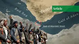
The graphic should be read as a map of the Middle East; it is a well-known tale of blocs, an Iranian axis, a Saudi-Egyptian-Turkish block, and an Israel-UAE block. When read as a nautical map, it conveys a more specific message. The light-blue territories are grouped around chokepoints and coastlines. Somaliland borders the Bab al-Mandeb strait, the entrance to the Red Sea and international shipping routes. It is across the sea from Southern Yemen. There is a pattern to the way land is used to access water in Sudan’s Red Sea coast and Ethiopia’s quest for sea access. For this reason, the concept of national borders fails to function as an analytical frame. A shipping lane doesn’t differentiate between “Middle East” and “Africa”, nor do the actors playing along it. There is no doubt that the Houthis’ missile strikes from Yemen that have impacted insurance and routing decisions for ships heading to Suez have been felt far beyond the borders of the country.
The mapped alignments have a familiar rationale: freedom of access is prior to sovereignty. Somaliland is closely connected to the UAE, with DP World investing in port infrastructure in Berbera. A port is not only a commercial asset but also a strategic option, providing a range of logistical, surveillance, and basing opportunities that a state lacking a coastal frontage on the relevant waters would not likely have access to otherwise. Israel’s own situation exemplifies this situation. Somaliland’s recognition by Israel came in December 2025, which the Somali federal government did not accept. From a legal standpoint, the move was an opportunity for Israel to gain a foothold in Yemen, no matter what one felt about its legality. It isn’t a complicated equation for a state that has been directly targeted by shipping and security interests from that coast. The model is also reliant on local partners. A state that can’t or won’t exert its might extends its reach through organizations that own a territory, ports, or airstrips. It is less expensive and more covert than a formal alliance, but it also links outside desires to the fortunes of actors whose aims may conflict with their patrons’ desires.
What The Map Is Not
In this case, the discipline of analysis is more important than the drama of the image and three cautions are in order.
First, the map is not an Israeli document. It is an analytical product by two researchers at a German foundation, and Netanyahu borrowed it. It has been pointed out in several accounts that it gives an indication of emerging alignments and is not evidence of a formal alliance or of diplomatic recognition. A PM’s selection of the slide reveals his image of the region. It does not tell us what Israeli policy is. Second, colour coding levels the relationships between the parts of a problem, making them homogeneous. The inclusion of a recognized state, federal member state, a rebel administration, and a paramilitary force in one category suggests a cohesion that is probably not present.
The report on the map makes it clear that it does not indicate that all the entities on the map share a common foreign policy. Some of those entities are said to have limited interaction with each other and their own individual agendas. The term “friendly” is not quite what it sounds like. Third, don’t use a shared adversary as a strategy. The map could be a harbinger of the temptation to read into overlapping interests to see a centrally directed campaign. Israel and the UAE are more likely to be aiming for different goals, at least in part, and Abu Dhabi’s commercial and military activities in the Red Sea basin are proceeding at a far faster pace than Israel’s. The effects of convergence can be the same as those of coordination, but there is no one forcing it to happen. The analyst’s job is to distinguish between them.
Why These Matter
The most profound one is on the Somali front. The map distinguishes between the federal government in Mogadishu and Puntland and Somaliland in the other, with some observers cautioning that the internal divide in Somalia is in danger of repeating the regional conflict. This isn’t the only map that needs to be taken with a grain of salt. An external patron patronizes the subnational authorities, while local conflicts gain a geopolitical dimension. The dynamics of this situation can rapidly become entrenched, as is evidenced in Sudan and Yemen. The take-home message for the policymakers is that the Red Sea cannot be perceived as a fringe of Gulf affairs. The Gulf rivalry, the Israeli-Iranian confrontation, the Sudanese war and the divergence of Yemen and Somalia are the usual topics that are analysed separately, between theatres. A security order created with ports and local partners will be tempestuous and unstable, as it will rely upon the politics of each link.
The lesson that analysts can learn is humility in relation to the artefact. The map is not a discovery; it’s a hypothesis. Its significance is to push an issue to a head that national-border thinking refuses to acknowledge: Who is competing for access to this sea? How? At whose expense? That’s not done by following some colours on a slide; it’s done by following shipping lanes, port concessions, and some armed actors.
If you want to submit your articles and/or research papers, please visit the Submissions page.
To stay updated with the latest jobs, CSS news, internships, scholarships, and current affairs articles, join our Community Forum!
Find our FREE quizzes and MCQs here!
The views and opinions expressed in this article/paper are the author’s own and do not necessarily reflect the editorial position of Paradigm Shift.

Tehreem Zainab is an 8th-semester BS International Relations student at the International Islamic University Islamabad (IIUI). Her academic interests include geopolitics, international security, foreign policy, great-power competition, and emerging global challenges. She is particularly interested in understanding how changing power dynamics shape international affairs.